Application and supporting records · PLAN-C
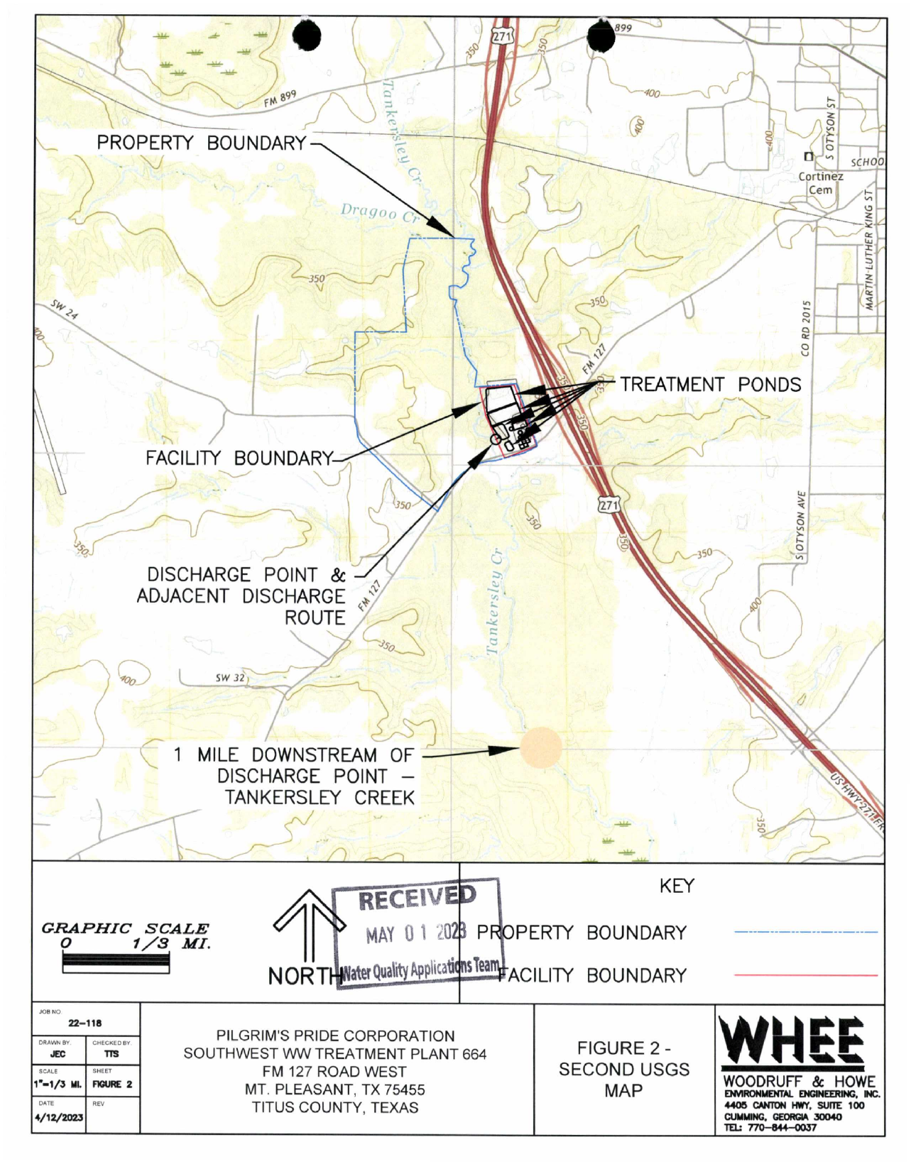
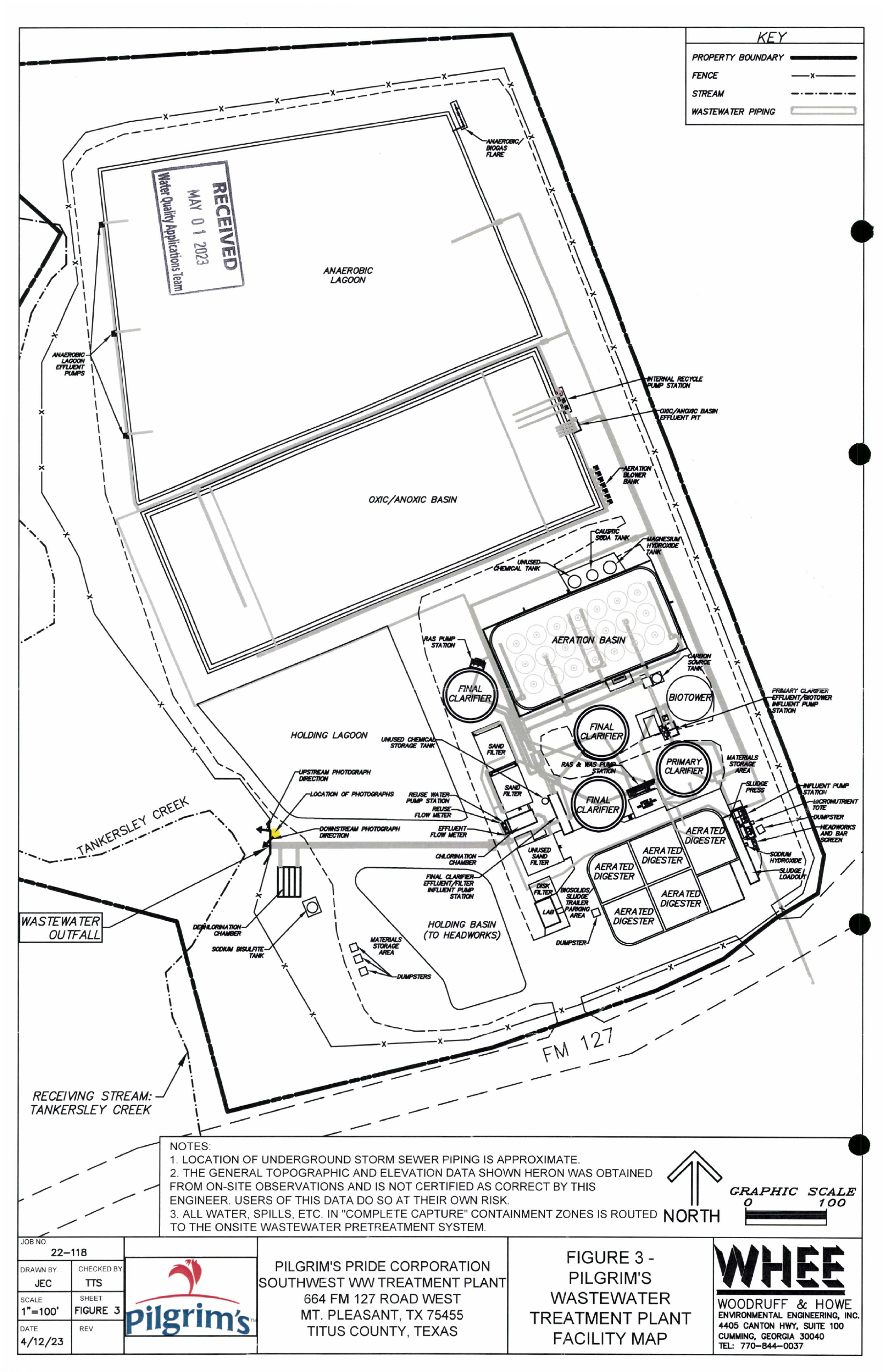
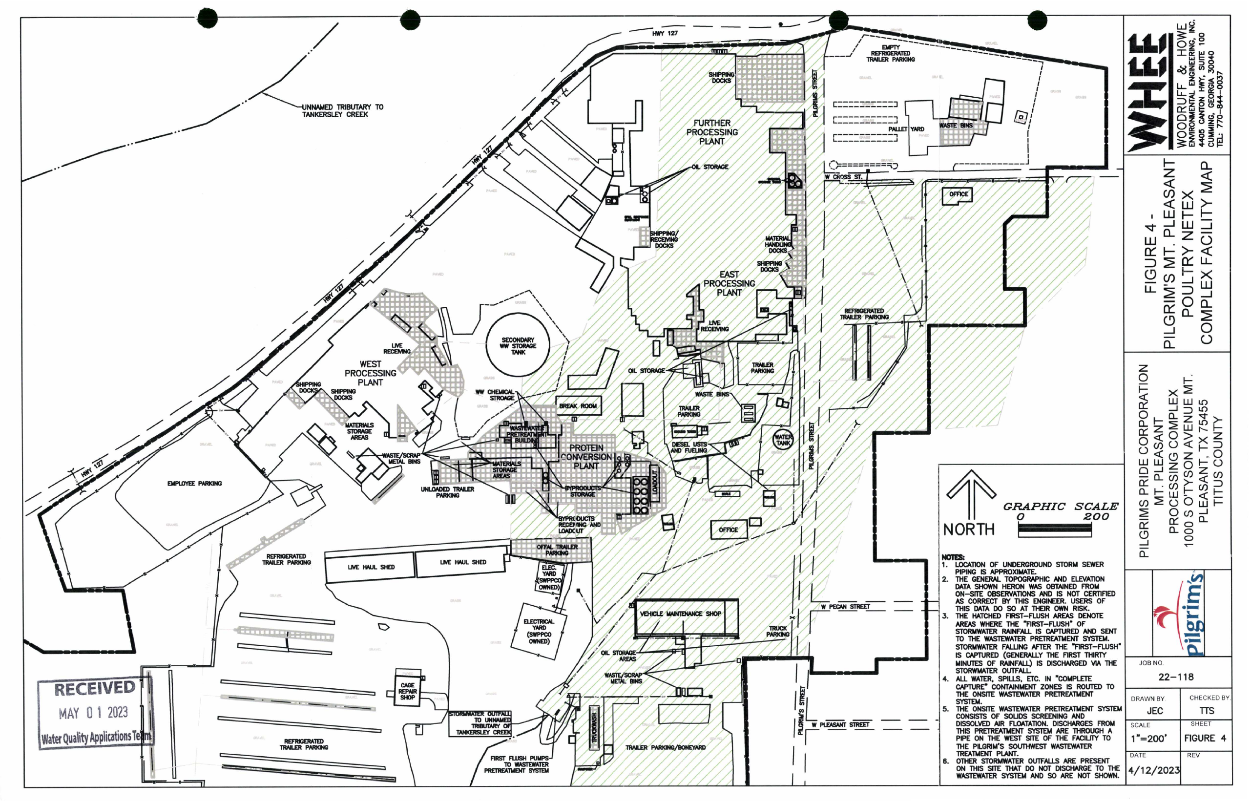
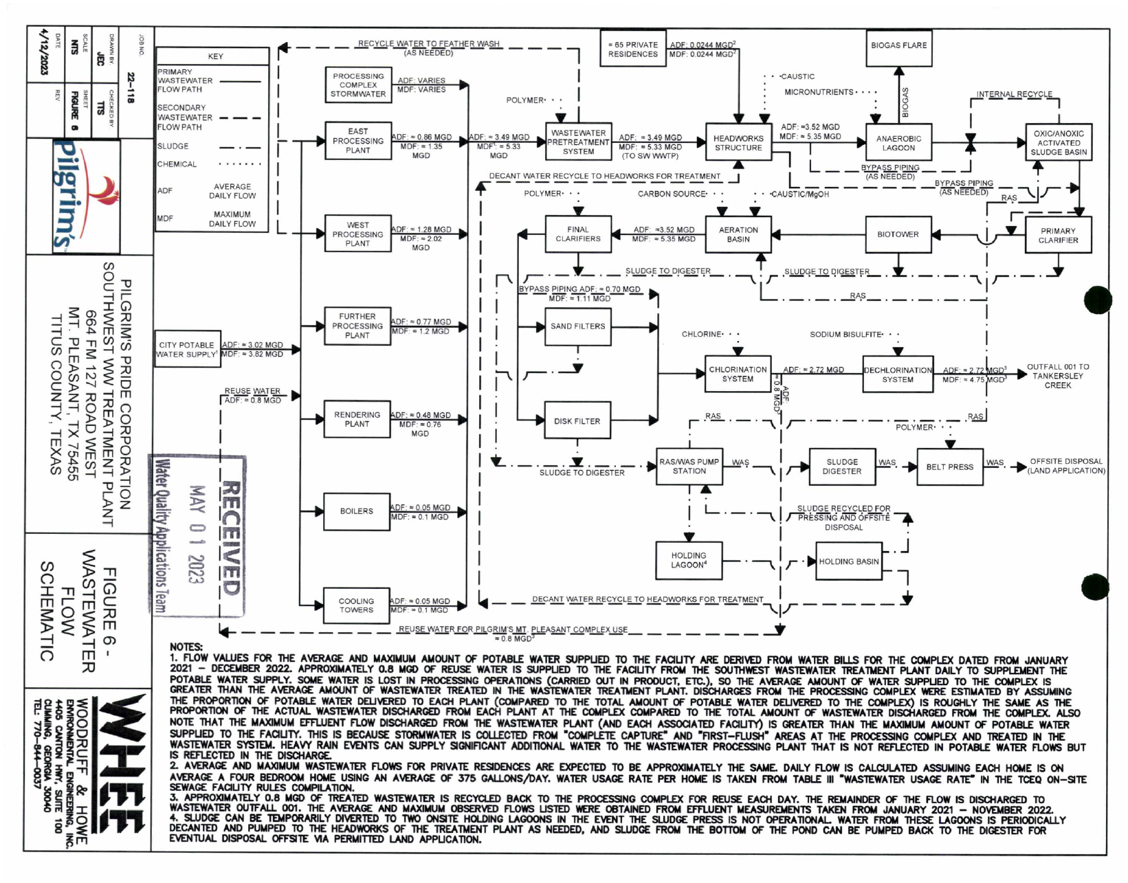
Application maps and flow schematic
Application maps and flow schematic, as produced by the agency. Drawing dates, estimates and source qualifications remain part of the record; these documents do not independently establish current or as-built conditions.
Source pages 452, 454, 456, 459, 688 · 5 source pages · Selected records
About this selection
These pages come from the 688-page TCEQ production for the Southwest wastewater plant. Page labels below identify the original production; selected source images and existing redactions are preserved.
Reading context and source notes
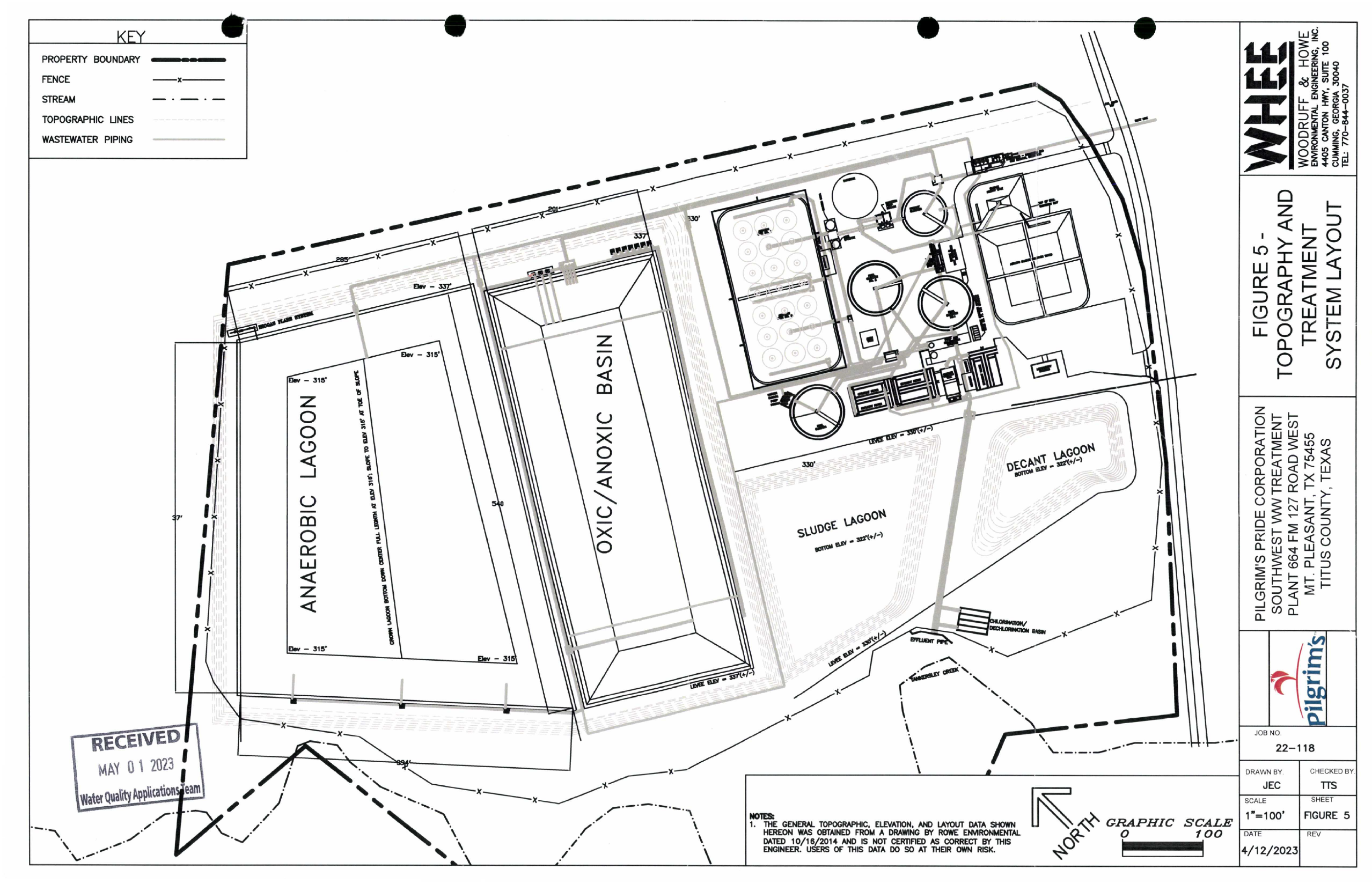
Five complete sheets in source order: Figures 2, 3, 4, 6, then 5.
Figure 5 is at source page 688, at the end of the agency production.
Legends, qualifications, scale bars, dates and professional attribution retained. No privacy masks were needed on these selected sheets; organizational contact details remain.
Figure 5 cites a drawing dated October 16, 2014 and disclaims certification of its accuracy. Other maps qualify piping locations, topography and elevation.
The flow schematic distinguishes observed values, estimated allocations and data periods. Map arrows do not establish that bypass events occurred.
These historical application sheets do not verify current or as-built conditions, separate SPIF submission, or present operating performance.
Related records
The application, models, sampling-waiver correspondence, maps and photographs explain what was submitted and reviewed. Compare them with the issued terms and separately dated monitoring records. An application-sampling waiver is not a waiver of routine permit monitoring; models, applicant estimates and source captions do not establish measured performance or current conditions.